(GPS) 05 Loano-Finalborgo-Noli
(Google Earth) 05 Loano-Finalborgo-Noli
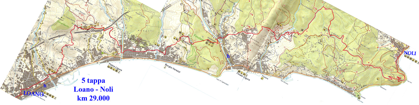
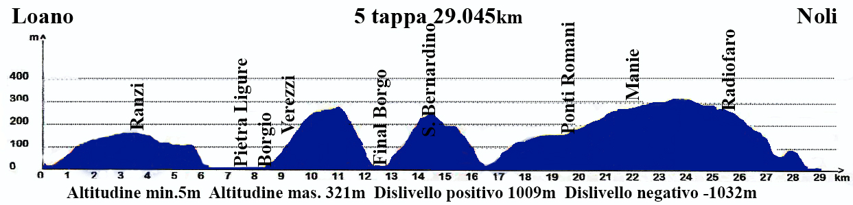
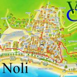
5° Stage: Loano – Noli 28,900km – Time: 7h30 – Difficulty: medium
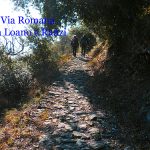
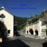
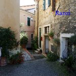
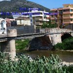
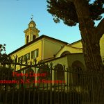
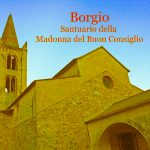
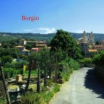
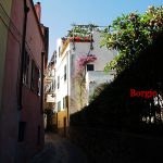
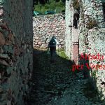
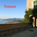
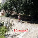
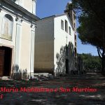
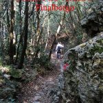
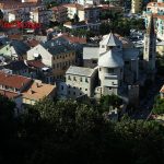
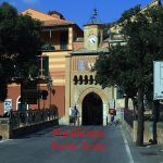
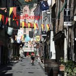
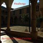
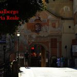
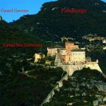
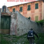
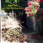
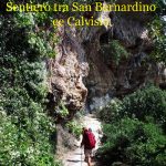
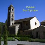
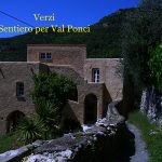
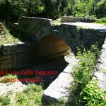
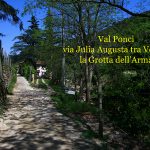
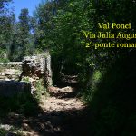
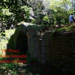
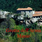
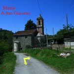
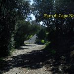
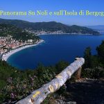
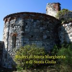
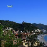
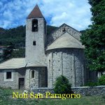
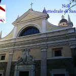
The route starts from the square of the Convento del Carmelo, we go down the wide pavement to turn left in Via San Damiano (path jubilee and the Roman road); we exceed the square of “Rolandette” where a beautiful little church stands and we begin to rise between olive trees. The road is paved, then at civic No.16 this road changes into a climbing dirt road, which becomes cobbled when we pass a votive pier. At civic No. 28 the asphalt takes up and we can see the church of San Damiano, where we can admire the “Loanese Gulf” from “Capo Mele” to “Caprazzoppa”; the church is located in the oldest site of Loano. We continue passing by the locked gate on the right of the church on paved road until we reach the sign Pietra Ligure and then turn left uphill on the white road “Via Castellari” (Route No.1). We continue staying on the main track, past the highway. We arrive shortly afterwards to an active pylon of the” ‘ENEL” and to a base of a pylon which is no more there, we turn right downhill on a roman cobblestone path that leads us to Ranzi on the square of S. Liberata, where we can enjoy a nice wash on the left, then we take the road uphill on the left and, immediately after the first intersection, go down to the right. Arrived near hotel “Ca’ Ligure” we turn right on paved road in ”Via B.Balzi and overcome another nice wash and a porch step. In the bottom of the path, we turn left uphill to reach the road again, passing on a highway overpass. Immediately after that, we turn left on asphalt, past a deposit of scrap cars, then we go down gently without taking account of a road that leads uphill to the dump. We continue until we reach the new residential area, then continue downhill to reach a fork; we go down to the left always on paved road and after several turns we continue on the right in ”Via Lombardia” along the stream Maremola. We pass the cemetery, and turn left over the pedestrian bridge, then we turn left in Via Soccorso (direction Borgio Verezzi). We go past the “Chiesa del Soccorso” (fountain), then we arrive to a rotunda, immediately after to the cross we continue to the left in “Via Santo Stefano”and “Via G. De Vincenzi” runs along the foot field, we reach the cemetery (fountain) and the church of “Madonna del Buon Consiglio” (road-signs: two yellow lines). We cross the bridge over the river “Bottassano” and we go uphill on the cobbled road “Salita alle Grotte”; after passing it, we turn right to reach the church in “Piazza San Pietro”: we are in Borgio Antica. On the corner of the church, we turn left and then in “via Cesare Battisti” (fountain), (road-signs: two green stripes), we get on a tree-lined avenue “Via Trento e Trieste”, and we are in front of the “Grotte di Borgio”. We continue uphill, road-signs: two red triangles, before walking on asphalt and after on a path into “Via delle Sevore” and after the water supply tank we continue on cobblestones to Roccaro. When we reach the votive pilar “San Giuseppe”, we continue on the left uphill in “Via San Giuseppe” and we enter into the land of Verezzi (hospitality), then we go to the beautiful “ Piazza S. Agostino” famous for its summer theater, after that we go left of the small church dedicated to the saint philosopher, cross the road and continue straight uphill on the cobbled street “Via della Crosa”, to reach another group of houses of Verezzi. We turn right under the little “Madonna” ,“Via alla Chiesa”, which reachs, after a cross between houses and gardens, two beautiful churches. We continue on the path that runs alongside the cemetery: (road-signs: three little red balls). We pass a large meadow on the right and there is a slight slope in the woods, then , exceeding the little pier dedicated to Madonna, the path descends to Finalborgo, we reach the paved road SS. 490, we turn left, then right, cross the bridge over the river Porra and enter Finalborgo, through the ancient door “Testa”(fountain). After” Via Nicotera”, “Piazza Garibaldi”, we reach the church of San Biagio. From here, we continue towards the ancient door, cross the bridge and the road then go straight uphill on asphalt, passing on the right the “Croce Rossa”, immediately taking up on the right “Via Monte Tabor”, a small cobbled road between gardens and countrysides . In this stretch we pass a newsstand “Mariana”, a small tunnel and then cross the road. We continue straight along the path until we reach No. 20, then we turn left as the sign for San Bernardino, walking 30 meters in floor tracks, turn right at a high concrete wall that runs alongside. The hard way is not always practicable for vegetation and a bog, but we come and we exceed the ochre villa civic No.103 on the cement steps, we cross the road and we take the path again. When we arrive at a group of villas and exceed another colored ochre one, we turn left along a nice cobbled path that overcomes the residential complex, then arriving at the olive tree we turn right and pass under an arch of a pink house to civic No.11; we exceed a votive chapel and we get the “trattoria Cucco” coming out on the road. The route goes right to the floor in the sports center, then at the first paved curve, we turn left down a path, after 20 meters turn left, just after that we leave the cobblestone reaching on a flat path: (road-sign: yellow ball). We continue downhill, past a swamp, then the trail follows a loop and passes under a rocky ridge. We still walk down to the main path: (road-sign: red line). We get over a circular bowl on the right and come to San Cipriano, a nice combination of medieval structure, we are in Calvisio. We continue downhill on asphalt. Once we reach a Marian votivechapel, turn left for a steep staircase coming down and passing an ancient village in “Via del Buon Viaggio”, then turn left on paved road to reach, after 100 meters, the bridge of “Verzi” with indication: Ponti Romani. After crossing it, we turn left uphill. After we take the shortcut on the right (road-sign: red dot), then again on the asphalt up to 100 meters and after three turns, on the right a cemented stairway leads us to Verzi. We pass a little church titled Mater Misericordiosa, just after we leave the path, turning left elbow on dirt, reaching the asphalt, we continue straight down the dirt road and immediately after we take the large path (Julia Augusta Valle Ponci). We go on dirt road, past three Roman bridges: (road-signs: red square and rhombus). Passed the third roman bridge, immediately after at the fork we turn right through the wood (road-signs: two red squares). The Roman path is clear and leads to the cave “dell’Arma”, where there is opportunity to rest; then we continue on asphalt to reach the church of ” S.Giacomo”, holding the left and a large, flat dirt road takes us to “località Ferrin”, then turn right on the asphalt and after 200mt. turn left onto the dirt road (road-signs: white arrow and striped dot). We reach the lighthouse of the Police and get off at U-curve, we turn left downhill, (road-sign: crossed red ball and red ball with n°1). The path is signaled by stakes in wood with the symbols of the pilgrimage. Continuing downhill we pass by the ruins of “St. Margherita”, where we can admire the beautiful view of Noli; we pass the ruins of “St. Lazzaro” and a stairway leads up to Villa Palma , we can reach the “Colonia Marina Monza”, then the square “Lorenzo Vivaldo”, we continue along “Via Collegio” until we reach the ancient proto-Romanic church of San Paragorio. We are at Noli. (hospitality)
Attention: The stakes in wood with the symbols of the pilgrimage are reliable only between the U-curve and Noli.
Hospitality:
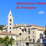
Finale Ligure
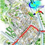
Verezzi: A Topia SAS (L) – Via Roma,16 – notice is necessary – Credential obligatory – apply Mrs Serena – 4 bedrooms+ 2 – tel.+39019616905 – doble room 60€ includes breakfast price for pilgims – dinner 25€ with 10% discount for pilgrims equipped with credential.
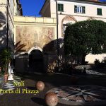
Noli:
Distances and reference marks:
Loano-San Damiano km 1,300
San Damiano-Ranzi 2° lavatoio km 2,400
Ranzi 2° lavatoio-Cimitero Pietra Ligure km 2,800
Cimitero Pietra Ligure-Borgio km 1,800
Borgio-Verezzi km 1,300
Verezzi-Chiese S.M. Maddalena e S. Martino km 0,660
Chiese S.M.Maddalena e S. Martino-Finalborgo P.Testa km 2,300
Finalborgo P. Testa-San Bernardino km 2,000
San Bernardino –Calvisio km 1,400
Calvisio-Ponte Rio Cornei km 0,820
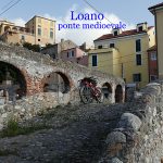
Ponte Rio Cornei-Verzi km 0,937
Verzi-incrocio per l’Arma km2,000
incrocio per l’Arma-Chiesa San Giacomo km2,000
Chiesa San Giacomo-incrocio SP45 km 0,927
trattoSP45- km 0,256
tratto SP45-Capo Noli faro Carabinieri km2,800
Capo Noli Faro Carabinieri -Noli km3,200
Totale km 28,900
Please report possible problems or proposals of improvement of the itinerary, writing to calsilvdc@gmail.com – Thanks for your help.
The 12 proposed stages and described were been in the years by the authors that decline every responsibility around possible changes on the territory that can alter how much it has described.

Questo articolo è disponibile anche in: